Project Abstract:
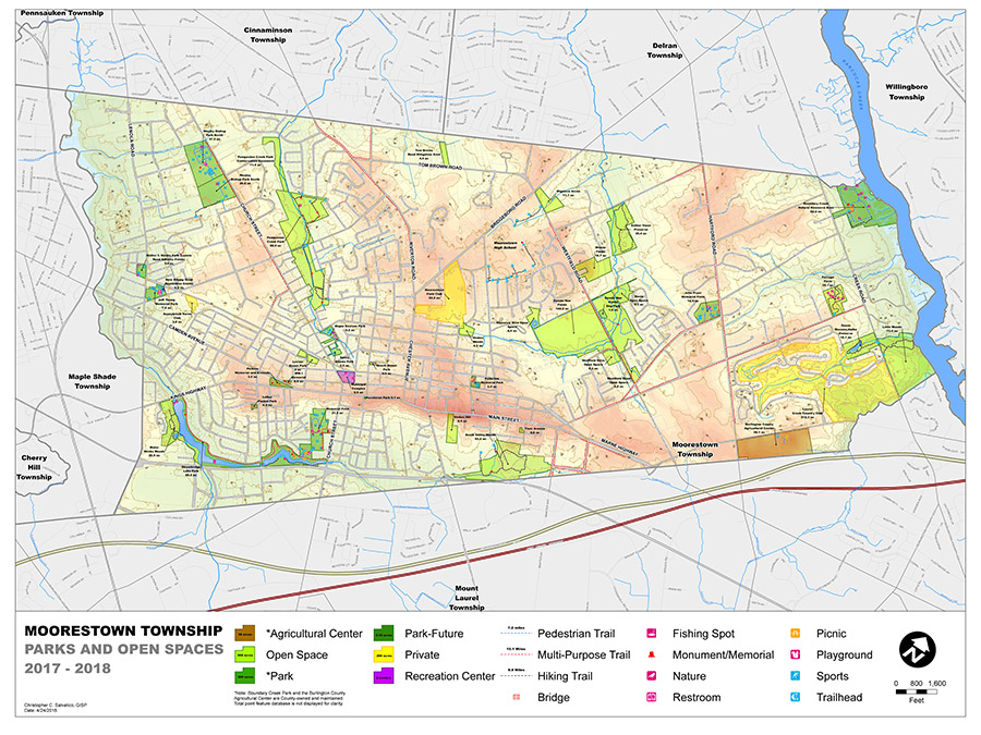
A volunteer effort organized through Sustainable Moorestown, Moorestown Township, Burlington County and numerous other volunteer groups, this project’s goal is the creation of a Parks and Open Space asset management system to help catalogue and promote the many recreational features of the Township.
Project Description:
Moorestown Township has been proactive in preserving open space as well as improving the Township’s current park inventory. The Township has documented their preserved open space on hard copy township maps and a limited number of handout brochures, but there are no digital maps available. As a result, there are many amenities that are added and improved to the existing stock that are not currently known to the surrounding community. To address this issue, Sustainable Moorestown, in conjunction with Town Council and other Township Committees concluded that to address that need the Township will develop a Park and Open Space asset management inventory.
With a GPS unit loaded with customized forms supplied and set-up by Burlington County Office of GIS, volunteers recorded assets and built a spatial geodatabase. This database included all the pre- determined features contained within the park or open space boundaries. The team was able to collect and catalog 45 recreational areas within the Township’s boundaries. This included 9 miles of hiking trails, 15 miles of multi-purpose paths, 7 miles of pedestrian walkways and 1 mile of internal park roadway. The team also collected 516 individual points ranging from baseball fields to trashcans within 1,233 acres of open space.
You can download a PDF of the map for your use by clicking here. The file is around 8mb and might take some time to download depending on your connection speed. The physical map size is 36″ x 48″. It is recommended that you right-click on the link and then select “Save Link As…” and download to your computer before opening the file.


